Netherlands Country Vector Maps
Netherlands Adobe Illustrator Maps
Royalty-Free • High Detail EPS Vector Maps • Download 24/7
-
Belgium Netherlands Luxembourg Map - High Detail
-
Amsterdam, Netherlands Map - Metro Area 360 square miles - with Major Roads
-
Rotterdam, Netherlands Map - Center - 16 square miles - with Local Roads
-
Netherlands Map with Capital, Major Cities, Roads and Water Features
-
Amsterdam, Netherlands Map - Center - 9 square miles - with Local Roads
-
The Hague, Netherlands Map - 72 square miles - with Local Streets
-
Netherlands Antilles Map
-
Multi Color World Map with Country Names in Dutch
-
World Multi Color Map with Country Names in Dutch
-
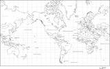
Black & White World Map with Country Names in Dutch
-
Netherlands Black & White Map with Capital, Major Cities, Roads and Water Features
-
Black & White Netherlands Map with Capital and Major Cities
-
Netherlands Map - Simple Outline
-
Netherlands Map with Province Areas and Capitals
-
World Map with Political Boundaries and Contours in the Water with Country Names in Dutch
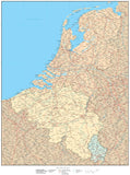
Country Maps in Editable Vector Format
All Map Resources country maps are available for download 24/7 as fully editable, layered Adobe Illustrator "high resolution" vector format files.
• All Map Areas - such as country areas, are vector objects so you can add or change color fills.
• Layered - All features are in layers: see the Feature/Layer list for each map
• All Lines - such as country borders, are fully editable
• All Text - such as city names, country names, etc is fully editable font text (not outlines) so you can change the size, color, style, etc.
• High-Res Maps - because our maps are vector graphics, they can be scaled to any size and will print at high resolution
• Compatible - with a wide variety of Adobe products, including Photoshop, AfterEffects, InDesign, Flash, etc.
Test Out a Map Yourself
Download a Free Map - sample maps in Adobe Illustrator vector format.
View our Free Videos on Using Maps in Ai Format
To see how our Adobe Illustrator maps work, see the instructional videos on our Map Design Tips page.
Note on Terrain Maps
All maps with "Terrain" in their map name also have a Photoshop "Background Relief Image" layer showing shaded relief terrain, in addition to the Illustrator layers of text, line, and area vector objects.
Note on Compatibility
You must have Adobe Illustrator (CS3 or later) to open and edit these maps. Our maps are saved as Adobe Illustrator CS3 files & are compatible with versions CS3, CS4, CS5 & CS6 for either Macintosh or Windows. These maps will not open with Adobe Reader, Adobe Acrobat or Adobe Acrobat Professional. If you do not have Illustrator, please consider our PowerPoint Maps.
Call us at 800-334-4291 or email us with any questions


