Results 1–41
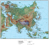
Asia Map Plus Terrain with Countries, Capitals, Cities, Roads, and Water Features
$ 99.95
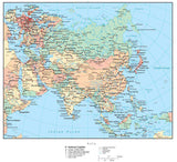
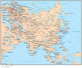
Asia Map with Countries, Capitals, Cities, Roads and Water Features
$ 49.95
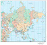
Asia Map with Country Borders, Cities, Roads and Water Features
Asia Map with Time Zones
$ 129.95
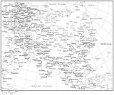
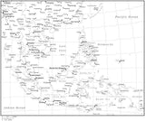
Black & White Asia Map with Countries, Capitals and Major Cities - ASIAXX-533888
$ 29.95
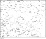
Black & White Central Asia Map with Countries, Capitals and Major Cities - C-ASIA-533927
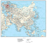
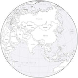
Black & White Globe over Asia Map with Countries
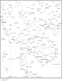
Black & White Indochina Map with Countries, Capitals and Major Cities - INDOCH-533887
Black & White Indochina Map with Countries, Capitals and Major Cities - INDOCH-533911
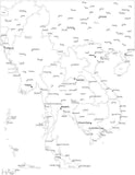
Black & White Southeast Asia Map with Countries, Capitals and Major Cities - SE-ASI-533884
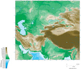
Central Asia Map Plus Terrain with Countries, Capitals, Cities, Roads, and Water Features
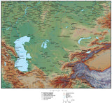
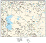
Central Asia Map with Contours
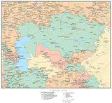
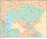
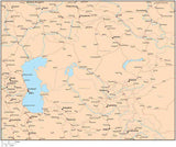
Central Asia Map with Countries, Capitals, Cities, Roads and Water Features
Central Asia Map with Country Boundaries, Capitals, Cities, Roads and Water Features
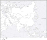
Digital Asia Map with Countries - Black & White
$ 19.95
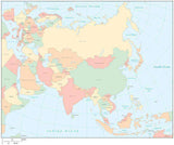
Digital Asia Map with Countries - Multi-Color
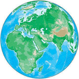
Globe Map over Asia with Contours
Globe Map over the Middle East with Contours
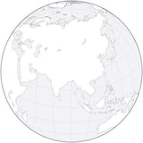
Globe over Asia Black & White Blank Outline Map
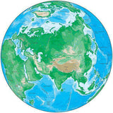
Globe over Asia Map Plus Terrain with Countries and Water Features
Globe over Asia Map with Countries and Water Features
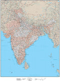
High Detail India Map with States & Union Territories Plus Terrain - 17 inches by 22 inches
$ 399.95
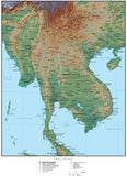
Indochina Map Plus Terrain with Countries, Capitals, Cities, Roads, and Water Features
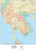
Indochina Map with Countries, Capitals, Cities, Roads and Water Features
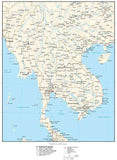
Indochina Map with Country Boundaries, Capitals, Cities, Roads and Water Features
Multi Color Asia Map with Countries, Capitals, Major Cities and Water Features
Multi Color Central Asia Map with Countries, Capitals, Major Cities and Water Features
Multi Color Globe over Asia Map with Countries
Multi Color Indochina Map with Countries, Capitals, Major Cities and Water Features
Multi Color Southeast Asia Map with Countries, Capitals, Major Cities and Water Features
Single Color Asia Map with Countries, Capitals, Major Cities and Water Features
Single Color Central Asia Map with Countries, Capitals, Major Cities and Water Features
Single Color Globe over Asia Map with Countries
Single Color Indochina Map with Countries, Capitals, Major Cities and Water Features
Single Color Southeast Asia Map with Countries, Capitals, Major Cities and Water Features
Southeast Asia Map Plus Terrain with Countries, Capitals, Cities, Roads, and Water Features
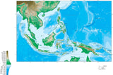
Southeast Asia Map with Contours
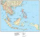
Southeast Asia Map with Countries, Capitals, Cities, Roads and Water Features
Southeast Asia Map with Country Boundaries, Capitals, Cities, Roads and Water Features