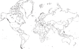
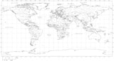
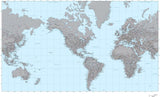
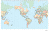
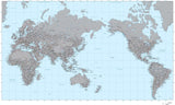
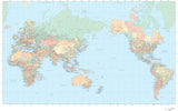
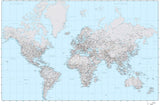
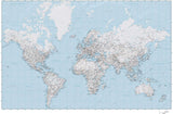
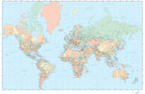
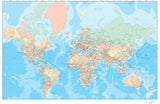
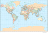
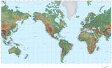
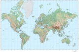
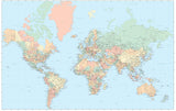
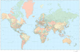
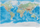
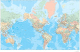
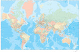
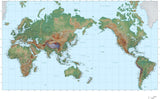
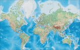
World Poster-Size Maps
Adobe Illustrator Poster Size World Maps - Our Most Detailed World Maps
Vector World Maps. Royalty Free License. Download 24/7
-
55 x 35 Inch World Map with US States and Canadian Provinces - plus Terrain in Land & Ocean Floor - Mercator Projection
-
35 x 22 Inch Poster Size World Map - High Detail plus Terrain - Mercator projection
-
35 x 22 Inch Poster Size World Map plus Terrain in Land & Ocean Floor - Mercator Projection
-
35 x 22 Inch Poster Size World map with Land and Water Terrain - Miller Projection
-
35 x 22 Inch Poster Size World Map - High Detail plus Grayscale Terrain - Europe Centered
-
35 x 22 Inch World Map - plus Country Objects and Grayscale Terrain - Europe Centered
Adobe Illustrator Format Maps
All our ".Ai" (Adobe Illustrator Format) maps are delivered as layered and fully editable Adobe Illustrator vector format files. You will need Adobe Illustrator (CS3 or later) to open and edit these maps. Our maps are saved in Adobe Illustrator CS3 file format, and are fully compatible with versions CS3, CS4, CS5 & CS6 for either Macintosh or Windows.
All features on our Illustrator vector maps are editable:
• All Map Areas - such as countries, states, counties, etc are closed vector objects so you can add or change the color fills
• All Lines - such as highways and rivers, are fully editable
• All Text - such as place names, state names, etc are fully editable font text (not outlines) so you can easily change the size, color, style, etc.
• High-Res Maps - because our maps are vector graphics, they can be scaled to any size and will print at the highest resolution
• Compatible - with a wide variety of Adobe products, including any version of Illustrator, Photoshop, AfterEffects, InDesign, Flash, etc.
• Layered - All features are in layers, so you can easily turn features on and off: see the Feature/Layer list for each map
Download a Free Map Sample in Adobe Illustrator Format:
You can download fully functional sample maps in Adobe Illustrator format.
View our Free Map Illustrator Training Videos on Using Maps in Ai Format:
To see how our Adobe Illustrator maps work, see the instructional map design videos on our Map Design Tips page.
You can use the tools in Adobe Illustrator to easily select and modify map features. For example, you could select an entire layer of area objects, line features, or text - and quickly change their color, line weight, or font.
Note on Terrain Maps:
All maps with "Terrain" in their map name also have a Photoshop "Background Relief Image" layer showing the terrain as shaded relief. This is a separate, linked Photoshop relief image file, 300 dpi CMYK color. This file can be opened and edited using Adobe Photoshop. The CMY (Cyan, Magenta, Yellow) channels show elevation color tints, and the K (black) channel shows grayscale hill shading. This file can be used as-is, and can also be modified separately to create a wide variety of map styles and appearances.
Note on Adobe Reader and Acrobat:
These maps cannot be edited with Adobe Reader, Adobe Acrobat or Adobe Acrobat Professional. If you do not have Illustrator, please consider our PowerPoint Maps.
Call us at 800-334-4291 or email us with any questions.


