Menu
Cart 0
Wall/Poster Size USA Map with Counties, Major Highways, Rivers, Lakes and More
Move your mouse over image or click to enlarge
Wall/Poster Size USA Map with Counties, Major Highways, Rivers, Lakes and More Wall/Poster Size USA Map with Counties, Major Highways, Rivers, Lakes and More

Wall/Poster Size USA Map with Counties, Major Highways, Rivers, Lakes and More

  • $ 399.95


More License Info

About This Wall Size Digital USA Map

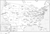
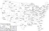
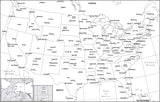
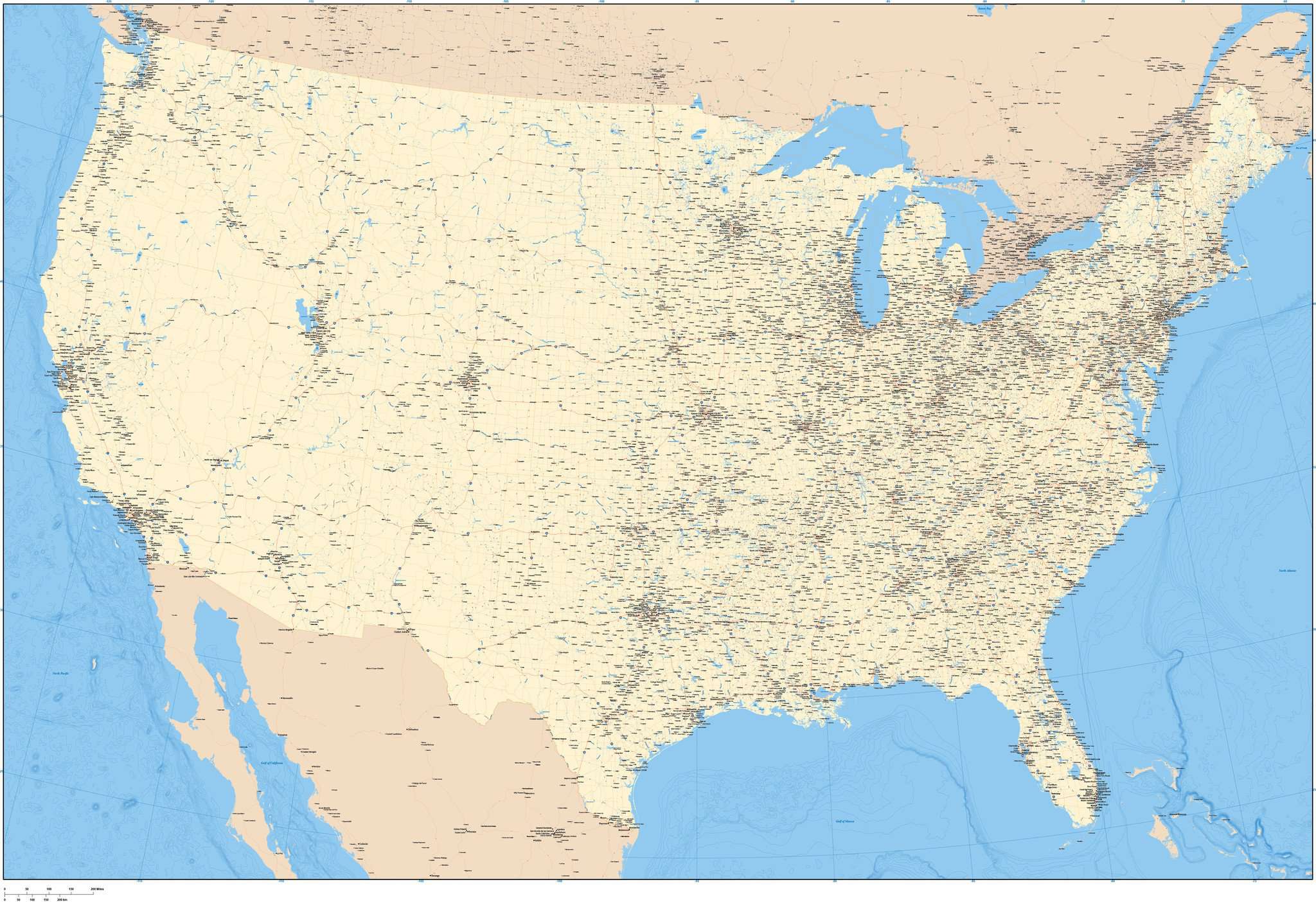
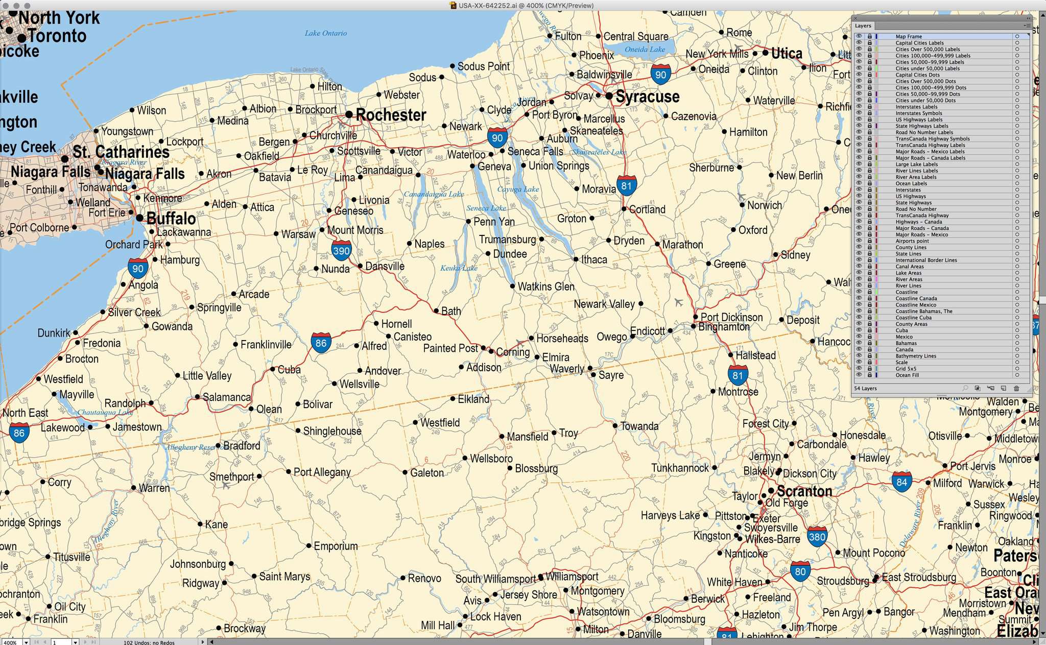
The largest USA map that Map Resources offers, this map includes every county, plus major highways, rivers, lakes, and city locations for the entire country.  The large dimensions allow for extremely detailed line work, resulting in intricately drawn roads, borders, rivers and coastlines that print beautifully even when enlarged.

In Illustrator format, each area is a separate object you can select and change the color. All lines are fully editable, and all text is fully editable font text (not outlines).

Created at dimensions of about 75 x 50 inches (190 x 127 cm). Scalable to any size. Perfect for wall size posters, and trade show graphics.

Conic Projection.

Adobe Illustrator Layer List on This Map

  • Canada Road Numbers
  • Canada Road Symbols
  • Canada Roads
  • Cities 100 000-499 999
  • Cities 50 000-99 999
  • Cities 500 000+
  • City - County Names
  • Coastline
  • Country Names
  • Country Polygons
  • County Boundaries
  • County Names
  • County Polygons
  • Frame
  • Great Lakes
  • Grid
  • Intermediate Lakes
  • International Boundaries
  • Interstate Highway Numbers
  • Interstate Highway Symbols
  • Interstate Highways
  • Island Names
  • Lake Names
  • Lat./Long. Degrees
  • Legend
  • Major Lakes
  • Major Rivers
  • Mexico Road Numbers
  • Mexico Roads
  • Mexico State Boundaries
  • Mexico State Names
  • Mexico State Polygons
  • National Capitals
  • Ocean Fill
  • Ocean/Sea Names
  • Province Boundaries
  • Province Names
  • Province Polygons
  • River Names
  • State Boundaries
  • State Capitals
  • State Names
  • State Polygons
  • Tick Marks
  • Toll Roads and Bridges

How Will I Download My Digital Map File?

Your receipt page will have a link to download your file, and you will receive an email with the same link. The link will be active for 30 days.


30 Day Money-Back Guarantee!


Download a Sample Map

See for yourself why our maps are the best! Download a fully editable sample map in Adobe Illustrator or PowerPoint Format.


Can't Find the Map You Need?

We can make one for you. Here's how to get a custom map...


Similar Maps