Results 1–13
Norway Map - Black & White Simple Outline
$ 19.95
Norway Black & White Map with Capital, Major Cities, Roads, and Water Features
$ 29.95
Norway Page Size Digital Map
$ 49.95
Norway Map with Administrative Areas and Capitals
Scandinavia Map with Contours
Scandinavia Map with Countries, Capitals, Cities, Roads and Water Features
Scandinavia Map with Country Boundaries, Capitals, Cities, Roads and Water Features
Scandinavia Map Plus Terrain with Countries, Capitals, Cities, Roads, and Water Features
$ 99.95
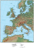
Western Europe Map Plus Terrain with Countries, Capitals, Cities, Roads, and Water Features
Western Europe Map with Land and Ocean Floor Terrain
$ 199.95
Norway Map - High Detail with Counties
$ 299.95
High Detail Norway Map Plus Terrain - 22 inches by 17 inches
$ 399.95
Scandinavia Map - High Detail