Map Resources - Using Our Maps in Other Formats and Applications
 |
 |
 |
 |
 |
Map Resources maps are now all PDF compatible, so EPS and JPEG users can use our maps!
If you have Adobe Acrobat, Adobe Reader, or Adobe Photoshop (any version) you can open our maps and use them in those applications!
For Adobe Acrobat or Reader, just launch the application and then use the menu command File > Open. The map will open in a new Acrobat or Reader document. Be sure to have the Acrobat "layers" visible.
For Adobe Photoshop, just launch Photoshop and then use the menu command File > Open. You will get a dialog box asking you to set the image size, resolution, and color settings. Just take the defaults, or change the settings as needed, click Open, and the map will open and be ready to work with in Photoshop.
For most other Adobe software you can use a similar procedure to open and use our map files.
So now our maps work even better with all the other great Adobe software that are compatible with Adobe PDF, Photoshop, and Adobe Illustrator!
If you are looking for other software that can work with Adobe Illustrator format files, a good place to start is this list of software that can edit our AI format map files, including:
Affinity Designer
BoxySVG
Canva
Corel Vector
CorelDRAW
Figma
Inkscape
Lunacy
Sketch
Vectornator
VectorStyler
Vectr
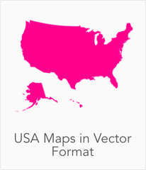
To see for yourself, please feel free to download a sample map in Adobe Illustrator format.

Download a sample map in Adobe Illustrator format. Open the map with Adobe Illustrator (CS3 or higher), or any other Adobe application, and then explore the features, editability and vector print quality.