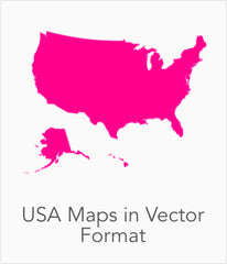
Adobe Illustrator Vector Maps - Layered & Editable Maps!
Map Resources pioneered the use of Adobe Illustrator® for map-making.
Using the graphic tools in Adobe Illustrator, we created a map collection that set the standard for professional quality vector maps for graphic design professionals.
Our maps are ready to use, and give you the flexibility to easily modify the appearance of the map to meet a wide variety of design specifications for any project - print, web, multi-media, and broadcast.
 |
 |
 |
 |
Use Adobe Illustrator to Modify Our Maps
- All Features are in Layers that you can turn on or off. Map features are saved in layers, which makes it easy to turn features on or off so you get to choose which features to include. Up to 75 layers per map, and every one can be manipulated independently. This allows us to provide a wealth of feature layers, without burdening the final map image.
- All Areas are complete objects you can select and modify. Every geographic area (eg countries, states, counties) is a separate object you can select and edit. This makes it easy to highlight specific states, geographic regions, cities, or provinces with color or fill patterns. Or create a custom area by selecting a group of objects and copying to new file.
- All Lines are fully editable. Every line on a map (eg road, boundary, river) can be edited. You can change color, line width, line style. If you want a dashed boundary, it's simple to create one.
- All Text is fully editable font text (not outlines). Text is font-based, so it's easy to change the font size and style. You can use your own choice of fonts. You can also add text with your own messaging.
- Vector Format for perfect printing. Vector format ensures a high-resolution printout, regardless how much you enlarge the image.
- Beautiful Terrain maps. High-res Photoshop file shows shaded relief terrain. Terrain in the background of the map file, with editable vector layers on top.
|
Download a sample map, open with Adobe Illustrator, and explore the editing potential and print quality. |
Watch map editing tips |

MapResources digital vector maps are used by thousands of organizations, and are available online for immediate purchase and download, using our secure e-commerce system.
All purchases are covered by our unconditional, 30-day, money back guarantee.