Menu
Cart 0
Digital Poster Size Ireland Terrain map in Adobe Illustrator vector format with Terrain IRL-XX-395353
Move your mouse over image or click to enlarge

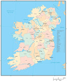
Poster Size Ireland Map - with Terrain

  • $ 349.95


More License Info

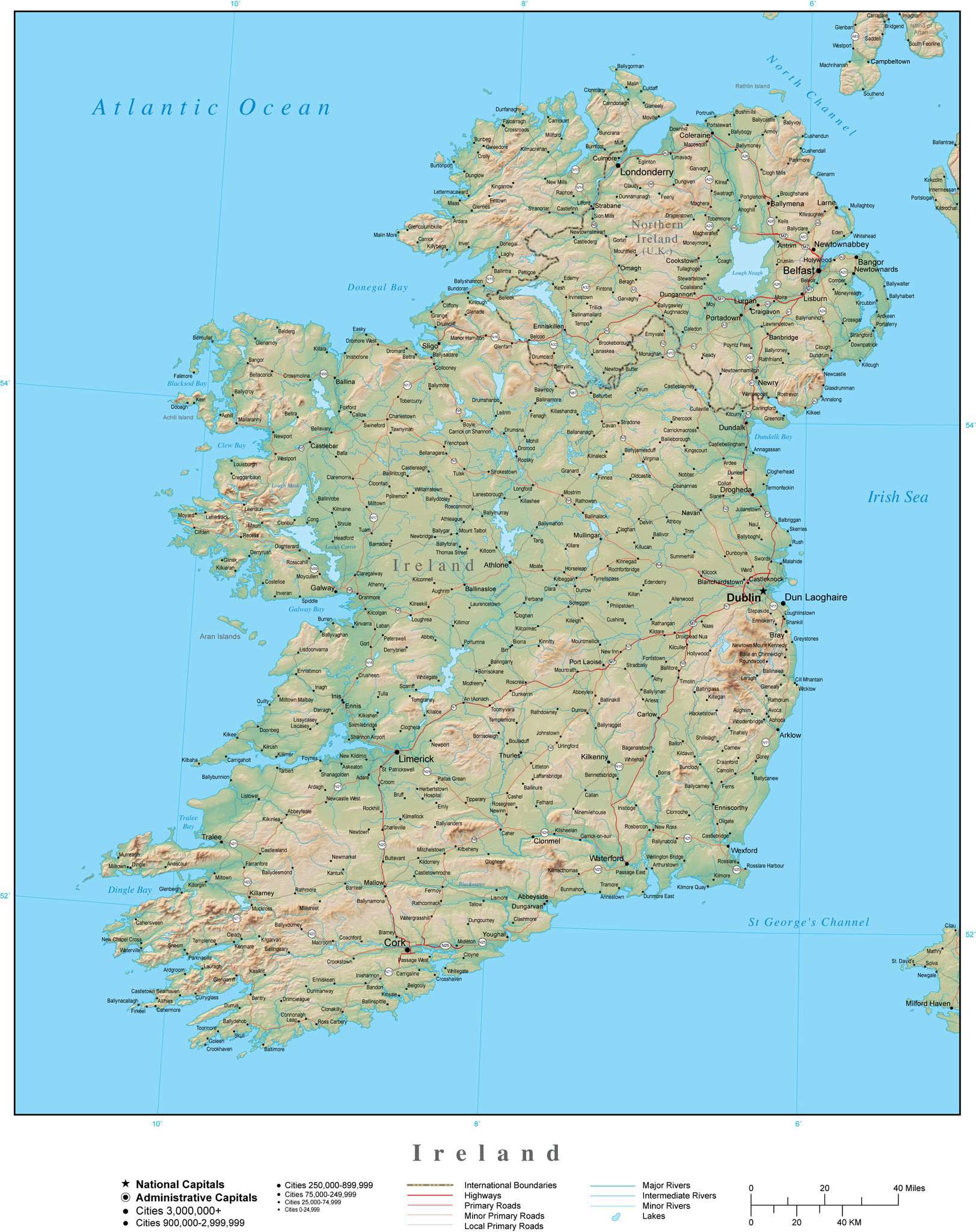
About This Ireland Map with Terrain

Includes terrain relief image in the land with country borders major cities rivers and roads.

In Illustrator format the background terrain is a 300 dpi CMYK Photoshop file so you can alter the background colors easily to your design specifications.  

Created at 16.5 x 19 inches (42 x 48 cm), so the terrain image resolution is about 4950 x 5700 pixels.

Perfect for large size posters or presentations.

Adobe Illustrator Layer List on This Map

  • Boundary Case
  • Cities 0-24 999
  • Cities 25 000-74 999
  • Cities 250 000-899 999
  • Cities 3 000 000+
  • Cities 75 000-249 999
  • Cities 900 000-2 999 999
  • Coastline
  • Country Areas
  • Country Names
  • Frame
  • Grid
  • Highway Numbers
  • Highways
  • Intermediate Canals
  • Intermediate Lakes
  • Intermediate Rivers
  • International Boundary Lines
  • Island Names
  • Lake Names
  • Lat./Long. Degrees
  • Legend
  • Local Highways
  • Local Primary Roads
  • Major Lakes
  • Major Rivers
  • Minor Canals
  • Minor Highway Numbers
  • Minor Highways
  • Minor Lakes
  • Minor Primary Road Numbers
  • Minor Primary Roads
  • Minor Rivers
  • National Capitals
  • Ocean Fill
  • Ocean/Sea Names
  • Primary Road Numbers
  • Primary Roads
  • Railroad
  • Relief Image
  • River Names
  • River Polygons
  • Tick Marks

How Will I Download My Digital Map File?

Your receipt page will have a link to download your file, and you will receive an email with the same link. The link will be active for 30 days.


30 Day Money-Back Guarantee!


Download a Sample Map

See for yourself why our maps are the best! Download a fully editable sample map in Adobe Illustrator or PowerPoint Format.


Can't Find the Map You Need?

We can make one for you. Here's how to get a custom map...


Similar Maps