Menu
Cart 0
Poster Size USA Map with Counties  Cities  Interstates  and Water Features - Platte Carre Projection
Move your mouse over image or click to enlarge

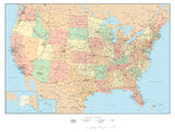
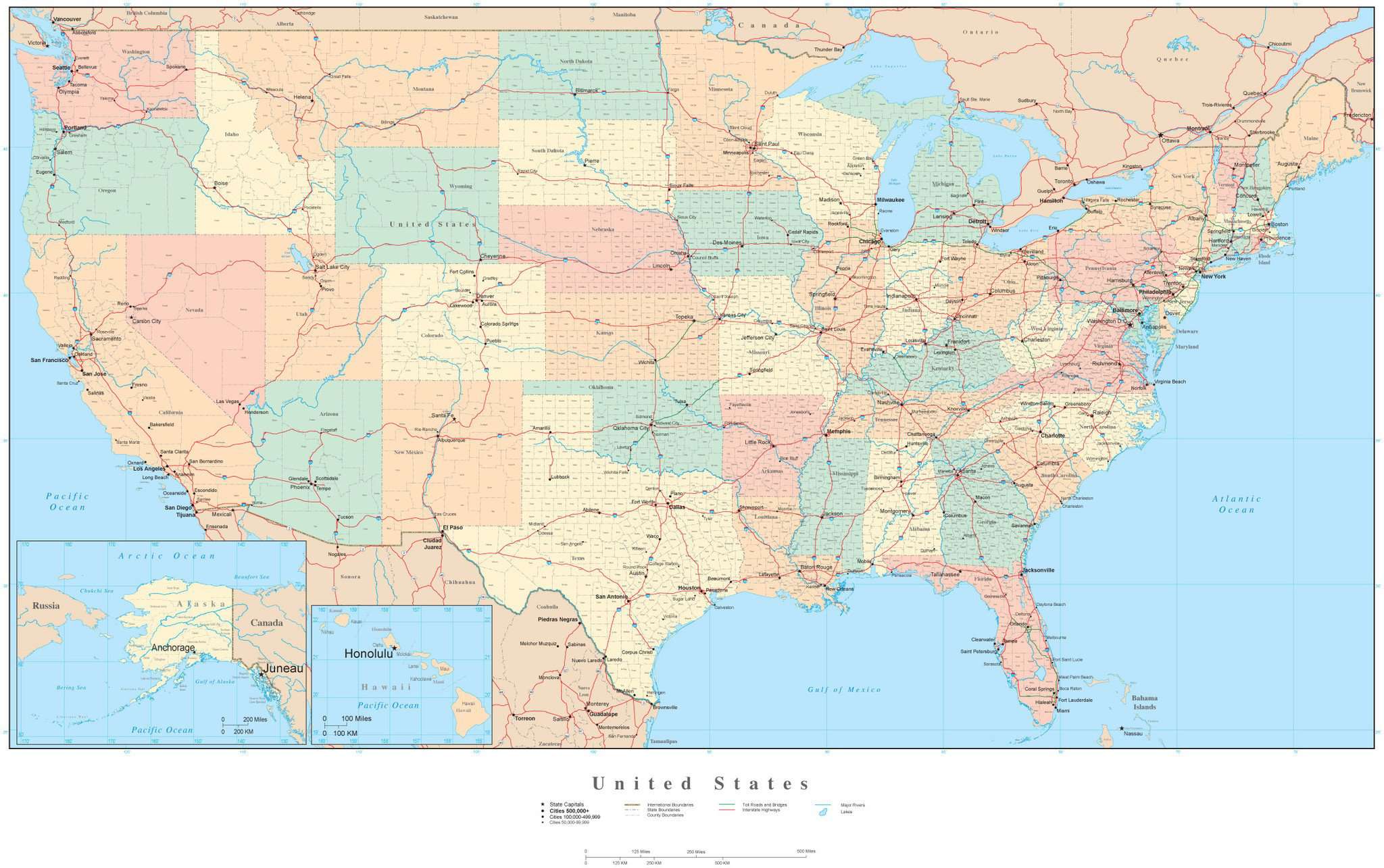
Poster Size USA Map with Counties, Cities, Interstates, and Water Features - Platte Carre Projection

  • $ 299.95


More License Info

About This Map

Shows the entire USA with all 3000-plus counties. Each county is a separate object area. Also shows major cities highways rivers and lakes.Framed out to include portions of Canada and Mexico.

In Illustrator format each county is a separate object you can select and change the color. All text is fully editable font text (not outlines).

Dimensions about 31 x 17 in (80 x 44 cm). Perfect for large size posters or presentations.

This map is also included in our Premier USA - High Detail collection, including maps of the USA and all 50 states.

If you need a map like this one showing a different area please contact our Custom Mapping Services.

Adobe Illustrator Layer List on This Map

  • Boundary Case
  • Canada Cities 100 000-499 999
  • Canada Cities 50 000-99 999
  • Canada Cities 500 000+
  • Canada Province Capitals
  • Canada Road Numbers
  • Canada Road Symbols
  • Canada Roads
  • Cities 100 000-499 999
  • Cities 50 000-99 999
  • Cities 500 000+
  • City - County Name Text
  • Coastline
  • Country Areas
  • Country Name Text
  • County Areas
  • County Boundary Lines
  • County Name Text
  • Frame
  • Great Lakes
  • Grid
  • Inset Boundary Case
  • Inset Cities 100 000-499 999
  • Inset Coastline
  • Inset Country Areas
  • Inset Country Name Text
  • Inset County Areas
  • Inset County Boundary Lines
  • Inset County Name Text
  • Inset Frame
  • Inset Grid
  • Inset International Boundary Lines
  • Inset Island Name Text
  • Inset Lat./Long. Degrees
  • Inset Legend
  • Inset Major Lakes
  • Inset Major Rivers
  • Inset Ocean Fill
  • Inset Ocean/Bay Name Text
  • Inset State Areas
  • Inset State Capitals
  • Inset State Name Text
  • Intermediate Lakes
  • International Boundary Lines
  • Interstate Highway Numbers
  • Interstate Highway Symbols
  • Interstate Highways
  • Island Name Text
  • Lake Name Text
  • Lat./Long. Degrees
  • Legend
  • Major Lakes
  • Major Rivers
  • Mexico Cities 100 000-499 999
  • Mexico Cities 50 000-99 999
  • Mexico Cities 500 000+
  • Mexico Road Numbers
  • Mexico Road Symbols
  • Mexico Roads
  • Mexico State Areas
  • Mexico State Boundary Lines
  • Mexico State Capitals
  • Mexico State Name Text
  • National Capitals
  • Ocean Fill
  • Ocean/Sea Name Text
  • Province Areas
  • Province Boundary Lines
  • Province Name Text
  • River Name Text
  • State Areas
  • State Boundary Lines
  • State Capitals
  • State Name Text
  • Tick Marks
  • Toll Roads and Bridges

How Will I Download My Digital Map File?

Your receipt page will have a link to download your file, and you will receive an email with the same link. The link will be active for 30 days.


30 Day Money-Back Guarantee!


Download a Sample Map

See for yourself why our maps are the best! Download a fully editable sample map in Adobe Illustrator or PowerPoint Format.


Can't Find the Map You Need?

We can make one for you. Here's how to get a custom map...


Similar Maps