Move your mouse over image or click to enlarge
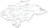
Honduras Map with Departments
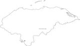
About This Honduras Map with Departments
Honduras with departments and capitals.In Illustrator each department is a separate object you can select and modify e.g. change the color. All text is fully editable font text (not outlines).
Use this map as-is or customize it using the tools in Adobe Illustrator.
If you need a map like this one showing a different country please contact our Custom Mapping Services."
How Will I Download My Digital Map File?
Your receipt page will have a link to download your file, and you will receive an email with the same link. The link will be active for 30 days.
30 Day Money-Back Guarantee!
Download a Sample Map
See for yourself why our maps are the best! Download a fully editable sample map in Adobe Illustrator or PowerPoint Format.
Can't Find the Map You Need?
We can make one for you. Here's how to get a custom map...
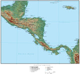
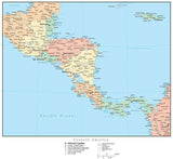
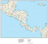
Similar Maps