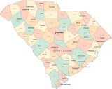
Digital SC Map with Counties & County Names - Multi-Color
About This South Carolina Map with Counties and County Names
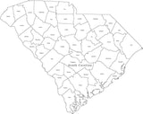
Shows individual counties, and county names.
In Illustrator and PowerPoint formats each county is a separate object you can select and change the color. All text is fully editable font text (not outlines).
Use as-is or color the counties to show sales territories etc.
Need All 50 States?
We also have collections which include all 50 US states with county areas in Adobe Illustrator Format and in PowerPoint Format. If you need a single map showing all 50 states with counties, consider one of our USA maps with County Areas.
How Will I Download My Digital Map File?
Your receipt page will have a link to download your file, and you will receive an email with the same link. The link will be active for 30 days.
30 Day Money-Back Guarantee!
Download a Sample Map
See for yourself why our maps are the best! Download a fully editable sample map in Adobe Illustrator or PowerPoint Format.
Can't Find the Map You Need?
We can make one for you. Here's how to get a custom map...
Similar Maps